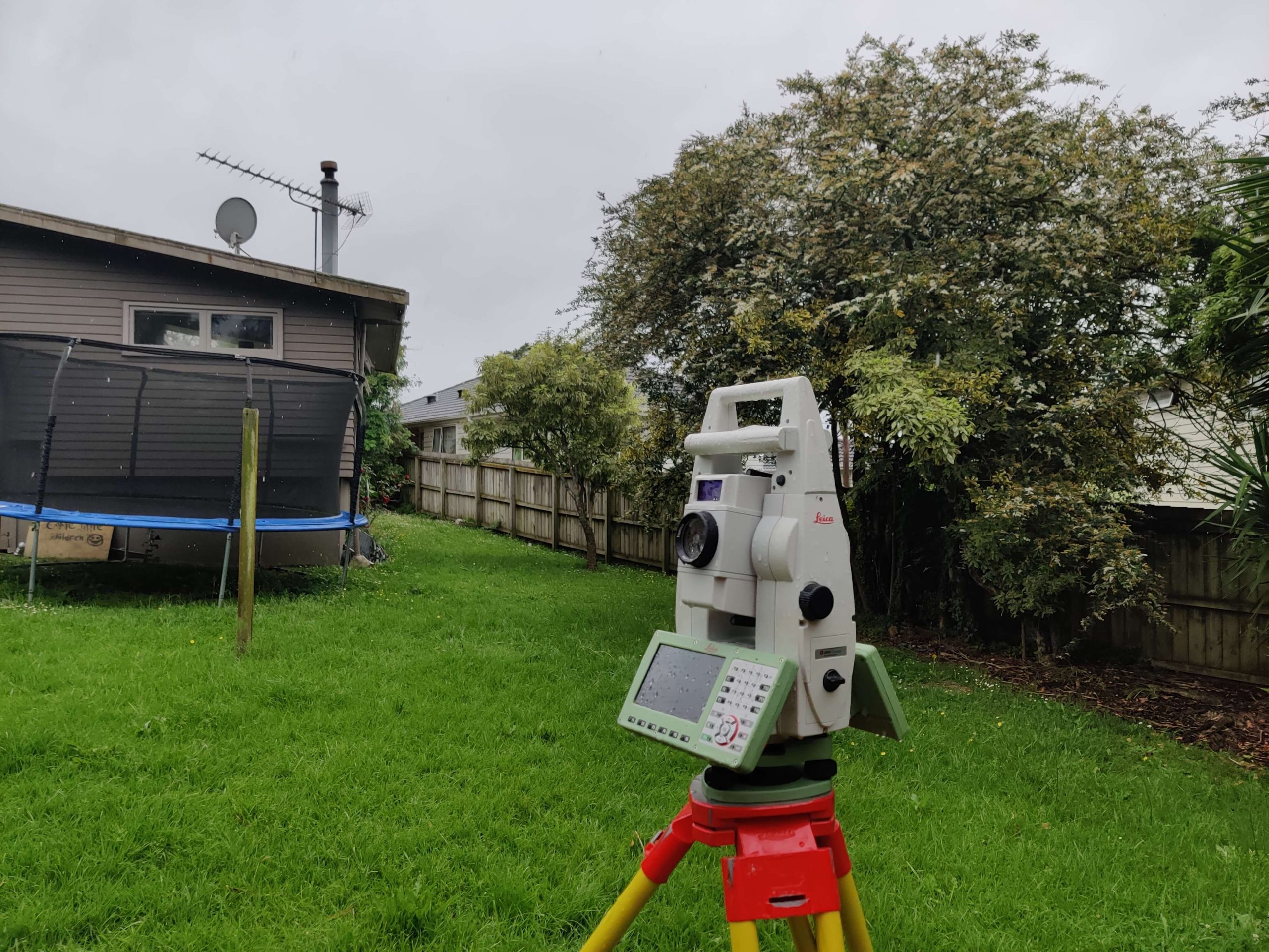
In land development and construction, a topographic survey is one of the fundamental surveys that architects, engineers, and land planners rely upon. It serves as a cornerstone for the planning and design of any development project, from residential homes to commercial buildings, and even infrastructure like roads and bridges.
This article delves into the inherent benefits of conducting a topographic survey and how it contributes to effective planning and design.
A topographic survey is a specialised survey that captures the elevations of the land and outlines both natural and man-made features, including buildings, trees, walkways, and more. Essentially, it provides a three-dimensional map of the land, revealing how the terrain might impact various aspects of development.
One of the most compelling reasons for a topographic survey is the accuracy it offers in planning. Knowing the exact elevations and dimensions of the land helps architects and engineers make well-informed decisions about the layout, design, and construction of a project. Without this essential data, the risk of costly mistakes and project delays increases significantly.
Understanding the natural features of the land is crucial for preserving environmental integrity. A topographic survey provides vital information about natural elements like slopes, water bodies, and vegetation. This data can guide developers in creating designs that are both aesthetically pleasing and environmentally sustainable.
Zoning laws, building codes, and land use regulations often require specific information about the land’s topography. A detailed topographic survey ensures that any development conforms to local and national laws, helping to avoid legal complications down the road.
The three-dimensional aspect of a topographic survey allows planners to identify potential problem areas, such as flood zones or unstable ground. Being forewarned about these challenges enables developers to take necessary precautions, thus mitigating risks and potentially reducing insurance costs.
One of the most recognisable features of a topographic survey is the contour lines, which indicate the elevation of the land. These lines are invaluable for understanding how water will flow across the site, which is crucial for drainage planning.
This includes information about hills, valleys, rivers, lakes, and vegetation. These features can be both constraints and opportunities in planning and design.
Apart from natural elements, a topographic survey also outlines man-made structures like buildings, fences, roads, and utilities. This is crucial for renovation projects and planning new constructions adjacent to existing structures.
While not a replacement for a boundary survey, a topographic survey can also indicate property lines, which is essential for legal documentation and for understanding the scope of the project.
Before any residential or commercial development, a topographic survey is often the first step in the planning process. It provides the essential data for designing buildings, roads, and utilities.
For projects like highways, bridges, and dams, a topographic survey provides engineers with the necessary data to make critical decisions about location, design, and materials.
In agriculture, understanding the lay of the land can assist in planning irrigation systems, plotting crop areas, and managing water flow, thereby maximising yield and minimising environmental impact.
Topographic surveys are also used in various environmental studies to understand landforms and to plan conservation efforts. They are particularly useful in assessing the impact of human activities on natural settings.
A topographic survey is more than just a map; it’s a comprehensive guide to the land’s features, elevations, and potential challenges. From initial planning to final construction, it plays a pivotal role in making informed decisions, ensuring legal compliance, and mitigating risks.
Whether you are a homeowner planning a renovation, a developer starting a new project, or an environmentalist looking to preserve a natural habitat, a topographic survey is an indispensable tool for effective planning and design.
When it comes to topographic surveys, experience and precision matter. Based in Auckland, New Zealand, Survplanz is a leading name in land surveying. As proud members of the New Zealand Institute of Surveyors, our team brings 18 years of expertise in construction and cadastral surveying.
Specialising in a comprehensive array of surveying services, including topographic surveys, commercial & residential boundary surveys and more, Survplanz leverages cutting-edge technology and industry expertise to deliver exceptionally detailed survey plans. So, whether you’re planning a subdivision, construction, or simply need an accurate lay of the land, consider Survplanz for a profoundly professional experience.

Land survey services are essential for land development projects for a plethora of reasons. Once you learn more about what they do and the kind of information they can provide you with, you’ll see why hiring a land surveyor to analyse your land before you start a construction project is so important.
Surveyors play an extremely vital role in ensuring that land development projects are completed safely and that they comply with all applicable NZ regulations. They can survey the land to give you information about things such as topographical features, property boundary lines and other very important details that you need to know before you start any kind of work.
Land surveyors can provide you with a variety of services to support your new land development project, such as:
With the help of professional land survey services, your project can be improved in the following ways:
Better Planning And Design. Surveyors provide accurate information about the property, such as its topography, boundaries, elevation and so much more. This information is essential for planning and designing the project in a way that ensures the structures built will be safe and sturdy. This can also make sure that the project is feasible and meets all of your needs.
Surveyors can help you identify the best locations for all of your development plans. By considering factors such as the topography of the land, the boundaries of the property and the availability of utilities, professional surveyors can choose the best parts of a property for specific structures.
More Efficient Construction. Surveyors support construction activities by setting out landmarks for construction workers to follow. This will help the project stay on plan and keep everyone and everything in the right places. If work is done in the wrong areas of the property, then mistakes could be made and your project could be delayed.
This is why contacting a qualified surveyor early on in your development project is so important. If you hire them for their land survey services before construction starts, they will identify the best areas for whatever you are planning. This can save you heaps of time in the future because you’ll know exactly where to start.
Total Compliance. Efficient land survey services and the details they provide will make it easier to fully comply with all applicable New Zealand regulations. This includes zoning laws, building codes and environmental regulations.
This is essential for avoiding costly and troublesome legal problems and for ensuring that the development project is completed safely and legally. For example, you can hire a surveyor to conduct a boundary survey that will pinpoint exactly where your property ends and the surrounding properties begin. This is useful because you’ll know where you can and cannot build.
A professional can help you understand if they need or don’t need certain permits for your development project. If you do need any, then they’ll help you understand what you can do to obtain the permits so that you can continue with your development.
Overall, land survey services play a vital role in any kind of land development project. Professional surveyors can provide accurate information and support you throughout your project.
Our team at Survplanz is here to help you ensure your project is completed safely, efficiently and in accordance with all applicable regulations in New Zealand. Our services can prevent frustrating and stressful problems down the track.
If you are interested, you can visit our site to learn more about what we can do for you. You can also call our team directly on 09 8695167 if you’d like to speak to us.
Make sure your project is a success, call us at Survplanz.
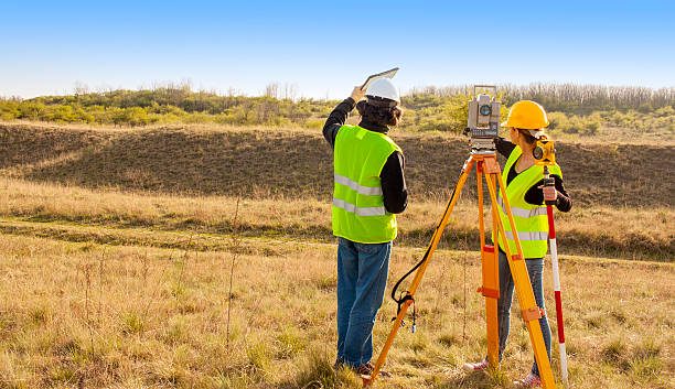
Registered surveyors or Licensed Cadastral Surveyors play a very important role in NZ. They provide essential services such as construction surveys, boundary surveys, topographical surveys and more – all of which help building projects go smoothly and successfully. Without their professional assistance, builders could make serious, time-consuming, expensive and even dangerous mistakes.
However, not every surveyor can provide you with the high-quality services you need. It’s important that you take steps to choose the best, most trustworthy professional for your surveying needs.
You can do this by looking for the right qualities and asking the right questions.
If you require the services of a Licensed Cadastral surveyor for your next building project in New Zealand, make sure you pay attention to these qualities:
Professional Registration. One of the best ways to make sure a surveyor is experienced, knowledgeable and fit for the job is to check if they’re officially registered as a Licensed Cdastral Surveyor with the Cdastral Survey Licensing board of New Zealand (CSLB). This means that they have met all of the board’s very strict standards regarding education, experience and competence.
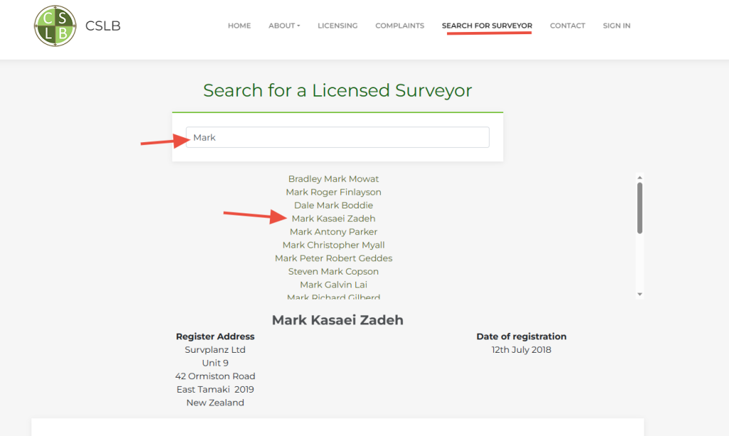
The other option is searching through Survey and Spatial New Zealand,
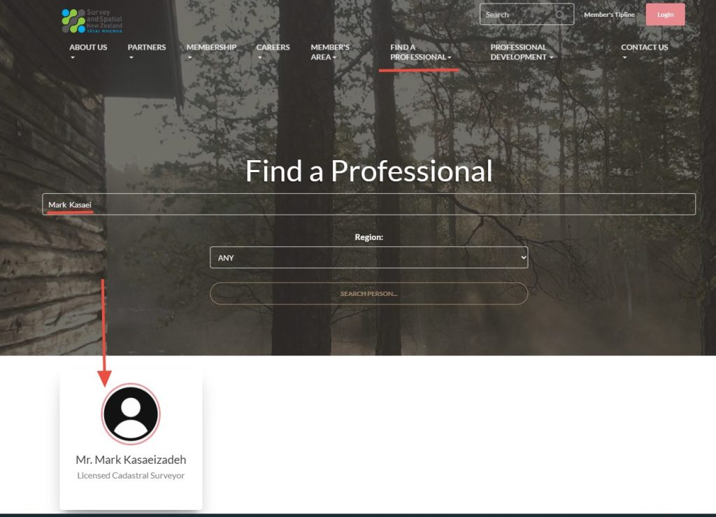
The SSNZ is the professional body for surveyors in New Zealand, so if a surveyor is registered with them and show in their title Licensed Cdastral surveyor or Registered Land Surveyor, you know you can depend on them. SSNZ sets the standards for surveyors and provides ongoing professional development for New Zealand.
By choosing a registered surveyor/Licensed surveyor , you can be confident that they have all the necessary skills and knowledge to perform the work you need to be done. You can trust them and know that their results are accurate and precise.
Professionalism. Licensed Cadastral Surveyors or Registered NZ surveyors are specialists, which means they should be professional, thorough and respectful when they work with you.
Along with offering fantastic services, they should also:
Experience. Ask the surveyor about their personal experience in the type of surveying you need. For instance, if you need a boundary survey, ask what their experiences with boundary surveys are like.
Experience is important because it means that the surveyor has the skills and knowledge to do the job correctly. Additionally, they’ll have past experiences and jobs to draw from if they run into any challenges or issues.
Along with asking them if they have experience with the specific type of survey you need, also ask them if they have experience with building projects similar to the one you’re planning. This will give you an idea of their ability to handle the specific requirements of your project.
You can also ask them about how long they think they’ll take for your project, what methods they use and any other questions you have regarding their services. Think about the various things you’ll want to ask your prospective surveyor before you contact them so you can get any answers you need from them.
Fees. Naturally, you should be aware of how much they’ll charge you for their services. It’s important that you keep an eye on your budget when you’re working on a building project so that you don’t spend more money than you can afford.
Keep in mind that hiring a suitable Licensed Surveyor or registered surveyor for your building project isn’t only beneficial, it’s also essential if you want to get accurate measurements. Their services can provide you with precise and accurate measurements and details that will significantly help you make your project successful.
Therefore, it’ll be best not to let fees dictate whether you do or don’t hire someone, as their high-quality services could be exactly what you need. Furthermore, your surveyor may also charge different fees depending on the type of services or surveys you require. Be sure you understand what they’ll charge for your specific project before you hire them or sign anything.
You may also want to get everything in writing. This can include the scope of the work, any fees and your payment terms. Having everything in writing can keep everyone on track and can confirm what each party is expected to do in the project.
If you require the help of a Licensed cadastral surveyor, then we at Survplanz are here for you. Our services include subdivision services, land transfer surveys, construction surveys, boundary surveys and more. We invite you to read about what we do on our website for more details.
We’d also be happy to answer any questions you have ourselves. You can easily reach our team by visiting our contact page, or you can simply call us on 09 8695167.
Survplanz: Providing you with the professional surveying services you need to make your project a success.
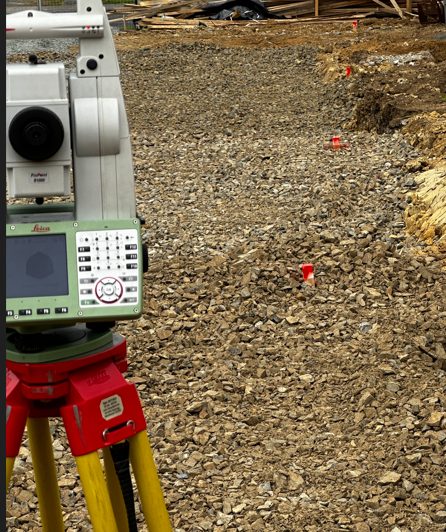
Construction surveys are essential for ensuring the precision and accuracy of building projects, as they provide builders and landowners with important information regarding the land. Building projects could go seriously awry without precise measurements, and significant mistakes could be made.
Surveying involves professional surveyors analysing and measuring the dimensions of a site. They are used to establish important details and locations for building projects, and the information they provide can help builders and designers make good decisions regarding their projects. Surveys can also identify any potential obstacles or hazards that people should know about when working on the land.
There are actually a few different kinds of construction surveys, and each can be used for different purposes. Here are a few of the most notable ones:
A drainage As-Built plan, drawn by a Licensed Cadastral Surveyor or registered surveyor is required when the public drainage system has been extended or new manholes/chambers constructed in the public system.
Councils often require this legal verification before the build proceeds to ensure everything is done right from the start. The surveyor work with you to ensure the building set out is completely accurate and produce the relevant setout certifications to satisfy Council inspectors and engineers.
The surveyor work with developer to ensure the road and drainage set out is completely accurate and all the services placed in the right position without interrupting each other.
These construction surveys document the actual dimensions and features of a structure after it has been built. An as-built survey can help to confirm that a structure has been built correctly. These details are essential for a variety of purposes, including obtaining the CCC or 224c from Council
It’s pretty clear that accurate construction surveys are extremely vital to any construction project. They can provide the essential information needed to ensure that a project goes well and that the resulting structure is safe and sturdy.
Accurate surveying is essential because:
They Can Help You Avoid Costly Mistakes. Surveys can identify any potential problems with a project before they occur, saving you heaps of time and money down the track.
For example, a surveyor can identify if a site is suitable for construction or if there are any notable obstacles that could cause issues in the future. If you’re aware of any issues, you can make the best decisions for your project now. This can help you avoid costly problems like delays and expensive reworks.
Ensure Compliance With Regulations. Surveys can help to make sure that a project fully complies with all applicable regulations. This can help you avoid the costly fines or penalties that could apply to you if you make any mistakes or disobey any laws.
For instance, a surveyor can help to ensure that the project is built within the correct setback requirements. Crossing property boundaries can result in troublesome conflicts with the landowner of the property you encroached on, so it’s best to avoid doing so as much as you can. A construction survey will give you a very clear layout of where you can build and where you cannot.
Facilitate Communication. An accurate survey can help to improve communication between all stakeholders in a project. This can keep everyone on the same page so that the project progresses smoothly and without unnecessary conflict.
This is why hiring a licensed cadastral surveyor is so vital. You need experienced surveyors who know how to efficiently and accurately measure a site without making mistakes so that you know the exact dimensions and details of your property.
If a surveyor can accurately provide a map of the construction site, then that map can be used to communicate the location of different notable features to the construction team and anyone else involved in the project.
Are you searching for reliable and experienced surveyors in Auckland? Look no further than our team at Survplanz. We’re prepared to provide you with a wide variety of services, including precise construction surveying.
We know that every project has its own unique details and challenges, so we’re here for you if you’d like to discuss your construction project with us. You can reach us on 09 8695167 or get in touch through our contact page.
Survplanz can help make your next building project a total success.

To design and build any structure with confidence, you need to know the lay of the land – literally. That means having the information you need, in a format, you can work with. Accurate ground and feature data are essential for the efficient planning and design of development works.
Whether you’re building a house, planning a large-scale subdivision or designing infrastructure a quality topographical survey is imperative. Any designer will tell you that a quality design depends on quality information – and not all topographic surveys are equal.
Our Topographical site surveys measure ground contours and record site features such as buildings, trees, fences, spot heights, public drainage services and other service locations, the boundary with occupations etc and can be customised to your end needs. Above picture shows a sample of our topographical plans.
We have the latest survey equipment and software, which assists our staff to produce top quality topographical site plans of your land. The plan produced will assist you, your architect and engineer to accurately design your project. We will provide you with a compatible price with the earliest time for field survey followed by the final plan in a few days later. Please fill the Request a Quote form and give us required information about your project.
A survey locating topographic features – natural and man-made, such as buildings, improvements, fences, elevations, trees, streams, contours of the land, etc.
It really depends on the availability of survey information in the area, the extent of the land, the slope and amount of vegetation in the land and some other factors. We at Survplanz provide a table for calculating the price of a Topographical Survey. You can find this table in Pricing Page.
To design and build any structure with confidence, you need to know the lay of the land – literally. That means having the information you need, in a type of file that you can work with. Accurate ground and features data are essential for the efficient planning and design of development works. This type of survey may be required by a Council or may be used by engineers and/or architects for the design of improvements or developments on a site. Whether you’re building a house, planning a large-scale subdivision or designing infrastructure a quality topographical survey is imperative.
Depends on each project requirements would be different, but generally, we’ll show all below items if applicable in our topographical plan. If you or your architect/engineer need any extra survey information please let us know.
– Legal description; Lot, DP and street address
– Boundaries including bearing and distances
– Abuttals boundaries, Lots, and DP numbers
– Spot levels, occupation and levels along boundaries
– Land Contours at 0.5m and 1.0m intervals
– Structures and impermeable surfaces
– Building floor level, eaves, ridges, steps, and decks
– Significant trees identified
– Services like stormwater, wastewater, power and telecommunication
– Driveways, footpaths, and channels
– Other features like top and bottom of walls, banks, streamlines
– Datum identified
– North Point, Scale, Date, Job No, address and Client name
You can find a sample of our topographical plan on top of this page
We use a very good quality and modern equipment which helps us to increase our speed and accuracy but generally, fieldwork normally takes 1 or 2 days for most of the normal site surveys.
You will complete the request a quote form and explain what is your requirement. We’ll use our different software to collect required survey, and title information and also we’ll use google earth and google street view to see how your site looks like. then we’ll come back to you with our fee proposal. If you wish us to proceed based on a provided fee proposal, we’ll send you engagement form for your approval. immediately after that, we’ll arrange the fieldwork date. We’ll come to the site on a date we agreed and complete the fieldwork. Now the first stage is done, we only need a few days to process your plan and send it to you.
We are working outside of the building and there is no need for you to be at home, However, we need you to be at home if you need to unlock the gates, or restrain your dog/s.
We’ll send you a PDF file and also a DWG file which is work for ACAD 2000 and above. Some architect also needs ACAD 3d or Tin file, that we can provide them as well without any extra cost.

We help you to find your property boundary lines in the following cases:
To get more information for the value of this service provide us with your details in the “Request a Quote” field. Please also note that Only a Licensed Cadastral Surveyor (LCS) can provide a redefinition survey service
FAQ:
What is the process for boundary redefinition?
When you accept our quote, we’ll search all existing evidence including plans provided by LINZ and calculate the boundaries and ties from existing survey references to those boundaries. With all required information, we will come to your site to either find the old pegs or mark out the legal boundary corners of the site. Extra marks or pegs can also be placed along the line of any legal boundary or offset from any boundary line if required.
Do we need to be at home when you are at the site?
We are working around the boundary and you don’t need to be at home but please make sure that we have access to boundary corners; it means no dogs and no locked gates. When we finished the marking we’ll place a stake by each mark, so will find them easily.
Who is the authorised person to place the boundary pegs?
Only a Licensed Cadastral Surveyor can legally undertake cadastral surveys to redefine boundaries
How much does it cost to survey a boundary?
There are so many factors involved to estimate the cost of the survey but our fees start from $550 plus GST and disbursement for a very basic road frontage survey. Contact us now to get a free quote for your boundary survey.
How can we find boundary marks by ourselves?
First, try to find the old pegs around corner posts of the fence or old boundary disks on top of the posts, if you were not successful, talk to your neighbours, if your neighbours have identified their property lines, you could request property line information from them directly. If you were not successful and still don’t want to involve surveyors on your job, you still have this choice to carry on by your self in your free time to find the old marks.
“You’ve heard it said that the job isn’t over till the paperwork is done? In this job, the paperwork comes first. Don’t set foot outside until you have in hand every document that could help. A copy of your title and survey plan will have that information.”
Usually, each boundary on a survey plan will have a bearing and distance next to it. If your distances were on links multiply the number of links by 0.201168 to give the distance in metres.
You are now nearly ready to step into the surveyor’s shoes. I found this article “Perform Your Own Home Property Survey” helpful if you only want to find the old marks but please note that in NZ only Licensed Surveyors allowed to redefine or mark the boundaries. Contact us now to get a free quote.